Welcome to another post on my blog. The last post, I posted about Malaysia and what to do there. In today's post, I am going to show you my Country Fact File that I have created.
What's a Country Fact File?
Well, a Country Fact File is one sheet which has data about that country. So the topic that I have chosen is Malaysia.
I hope you like my post on my blog. Comment down below if you have learnt something new. Have a cool day!! Bye!!
Welcome to another post on my blog. In today's post, we are going to learn about new information about Malaysia. First, let's know some information about the country.
Malaysia is one of the most popular tourist countries in the world, located in south-east Asia, having amazing attractions and incredible cultures. Malaysia is a multi-ethnic country with a population of 32,040,359 (in 2019).
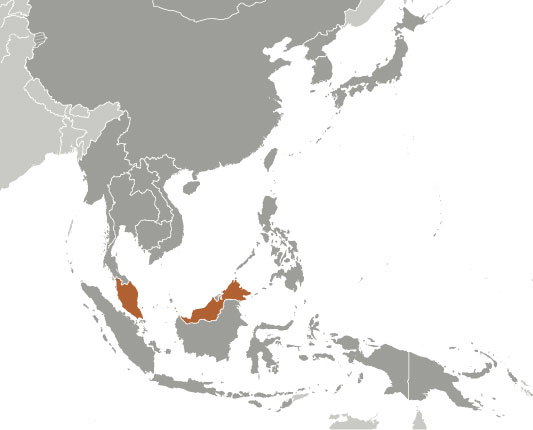
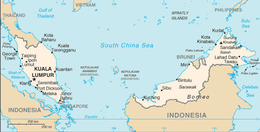
There are two parts of Malaysia which are divided by the South China Sea, peninsular Malaysia (West Malaysia), on the Malay Peninsula bordered by Thailand and Singapore in the south. The Malaysian Borneo (or East Malaysia), located on the northern part of the island of Borneo in the South China Sea, bordering Indonesia.
Let's know some facts about Malaysia.
According to Worldometers, the population of Malaysia is 32,040,359 in 2019.
Malaysia shares borders with Thailand, Indonesia, Brunei and Singapore.
The largest city in Malaysia is Kuala Lumpur.
The national animal of Malaysia is the endangered Malayan Tiger.
The world's largest cave chamber is the Sarawak Chamber, located in the Gunung Mulu National Park.
Malaysia holds 20% of the world's animal species.
The popular sports played in Malaysia are football, tennis, squash, badminton, field hockey, bowls, martial ars, skateboarding, sailing and horse riding.
There are a total of 28 national parks in Malaysia.
The tallest mountain in Malaysia is Mount Kinabalu at 4,095 m (13,436 ft) above sea level.
Menara Kuala Lumpur - Landmark tower with panoramic views
Redang Island - Island with beaches, resorts and diving.
Central Market Kuala Lumpur - Arts destination and vibrant shopping
Sunway Lagoon Club - Bungee jumping and an amusement park
Penang Hill - Mountainous park with views and hikes
Poring Hot Spring, Ranau, Sabah - Open-air mineral baths complex
Suria KLCC - Massive mall housing shops and restaurants
A Famosa - A Family resort with theme parks and golf
KLCC Park - Urban oasis with animated fountains
Langkawi Cable Car - Cablecar rides with majestic views
Sepilok Orangutan Rehabilitation Centre - Orphaned ape centre, open or visits
Perdana Botanical Gardens - Lush tropical park with a pond and a cafe
These are some of the amazing and wonderful attractions in Malaysia.
Map of Malaysia
Travel Guide | Expedia
Here is a travel guide of Malaysia by Expedia. Hope you like it.
I hope you like our post about Malaysia. Comment down below if you learned something new from this post. Also, comment down below if you've been to Malaysia before. Have a cool day!! Bye!!
For today's post, we are looking at the smallest country in the world. Do you know what's the smallest country in the world? Do you know where it is located? What is the population of the country? How big (I mean small) the country is? In this post, I will cover these questions. Let's know!!
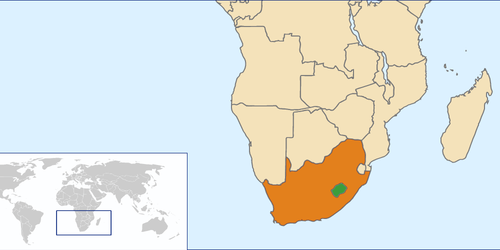
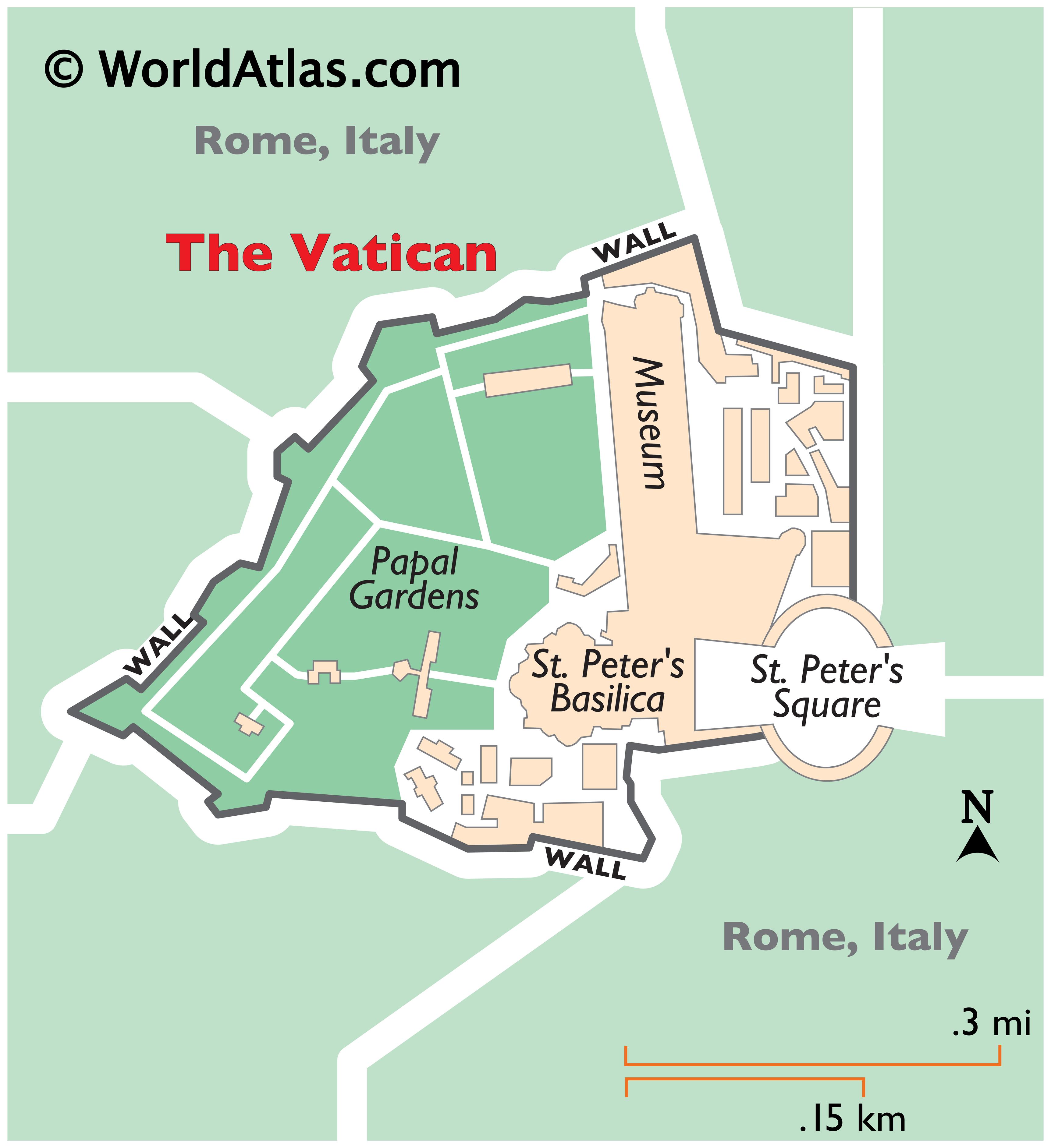
I'll give some hints. This country is located in Europe but in Italy. Weird? Well really, a country in a country is called an enclave country. Here's one example, Lesotho is a country in South Africa. On the right is a map to show.
So the country is...
Vatican City If you know more about maps and countries, this country might have come in your head. Vatican City is the smallest country in the world. Vatican City is a country in Rome, Italy. As I told you, Vatican City is an enclave country. Let's know about facts about Vatican City.
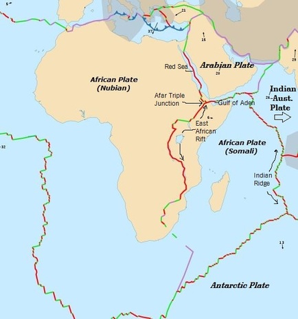
Yes, it is true, Africa is breaking up in two pieces. Do you think that you believe me? No, yes?
So, let's go back to the topic. Africa is breaking up because the two plates, Somalian and Nubian Plates are moving away from each other. On my Plate Tectonics post, I had written that,
It's the Plate Tectonic is the Earth's outer shell that is divided into several plates that move over the mantle. These slow-moving structures interact with each other.
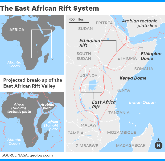
This is called the 'East African Rift System' (EARS), which is one of the geologic wonders of the world. To make it easier to understand, a rift is like a fracture on Earth's surface.
How Did It Start?
So what happened was that the massive cracked suddenly appeared in Kenya. The crack began to grow because of heavy rain. This made the Kenya-Nairobi highway which made the highway collapse. This is one good example of Plate Tectonics. This active rift zone is spreading a few millimetres every year. Which means, around 10 million years after, a new ocean will emerge as the East Africa tears apart.
Heavy Rain in Kenya reveal huge cracks which show
Africa splitting into two continents
Credit: https://qz.com/
I hope you like my post about Africa breaking up. I hope you learnt heaps of information from this post. Was it mind-blowing 🤯🤯? Comment down below what you've learnt today. Have a cool day!! Bye!!
For today's post, I will be posting about a famous country named Canada (as you know from the title and flag). Most of you know know that Canada is located in North America, above the United States of America. Last post, I had posted about Laos, which is a country located in Asia.
Canada is in North America, right? North America and South America's land is together, named is called Americas, which is a supercontinent. There are two supercontinents Afro-Eurasia, which has a population of 6.1 billion in 2013 and the Americas which has a population of 1.002 billion in 2016. That's amazing, right?
Let's get back to the topic, here are some facts about Canada:
The U.S.-Canada border is the longest border on Earth with a length of 8,891 km.
Canada has fewer people than in Tokyo's metropolitan area.
Ontario, Canada has more than 250,000 lakes, which is 1/5 of the Earth's fresh water!
Canada is 1.5% larger land than the U.S.
Canada's national parks are free for kids.
A weird fact: The Hawaiian Pizza was invented in Canada and is the most popular pizza in Australia. That is weird right? 🤔
I hope you like the facts about Canada. This information is from www.factslides.com, which provides really good informative information. Now let's know 20 things to do in Canada.
20 Things to Do in Canada
CN Tower - a 553.3-metre high observation tower located in the city centre of Toronto.
Stanley Park - a park located in Vancouver. This 405-hectare (1000 acre) park, which around 8 million people come annually.
Capilano Suspension Bridge - a simple suspension bridge which crosses the Capilano River in North Vancouver. The bridge is 170-metre long and 70-metre above the river. Around 800,000 people come there every year.
Yoho National Park of Canada - which is in the Rocky Mountains, in the eastern British Columbia. The national park is known for mountains, waterfalls, wildlife and trails.
Athabasca Glacier - a majestic, glacier for hiking.
Peyto Lake - a lake known for mountains and glaciers. The lake is near the Athabasca Glacier.
Maligne Lake - a lake with spirit island and mountain views. The lake is close to Athabasca Glacier.
Gastown - a shopping area. Which is famous and known for its souvenirs, steam clock and trendy eateries, located in Vancouver.
Emerald Lake - a lake in Yoho National Park which is known for the lake, mountains and glaciers.
Mount Royal - a large volcanic hill or small mountain in the city of Montreal, west of Downtown Montreal, Quebec, Canada. Montreal takes its name from Mount Royal, which is a hill with a lookout.
Old Quebec - which is rich in historic landmarks and museums. Old Québec is located in Québec City.
Horseshoe Falls - which is also known as the Canadian Falls, it is located in Niagara Falls. Well, Niagara Falls is in the United States but the falls is in Canada?
Skylon Tower - which has a magnificent (outstanding) view of Niagara Falls.
Montmorency Falls - a grand waterfall surrounded by parkland. The falls is located in Québec.
Parliament Hill - known as The Hill, in Ottawa, the capital city of Canada.
Lake Louse - a picturesque lake by Emerald Lake and Yoho National Park. The lake is located in Alberta.
Sunshine Village - a big attraction-filled ski resort. The ski resort is in Alberta.
Lake Minnewana - a glacial lake, the 2nd longest lake in the mountain parks of the Canadian Rockies.
Sulphur Mountain - a hike or gondola ride to dramatic views in Banff National Park.
Vancouver Aquarium - located in Stanley Park in Vancouver. Which has educational aquatic exhibits and shows.
Map of Canada
Travel Guide | Introducing Canada | Lonely Planet
I hope you like my post about Canada. Comment down below if you learnt something new about Canada. Have a cool night!! Bye!!
For today's post, we are going to look at a country in Asia. Can you guess what it is? 🤔
Last post, I had posted about Somalia, which is a country in Africa. If you haven't seen it please check it out, also comment down what you had learnt about the country.
Now this country, which is located in Asia. Asia is located in the borders of Europe and Africa. The continent with Asia and Europe is called Eurasia, which is a continent which connects Asia and Europe.
For today's post, we are going to look at a country in Africa. Can you guess what it is? 🤔
This country is located, East Africa. This countries name is Somalia, above Kenya. There are ten states in Somalia:
Awdalland
Central Regions State
Galmundug
Hirshabelle
Jubaland
Puntland
Zeila and Lughaya
Somaliland
South West State of Somalia
Khatumo State
10 Facts about Somalia
The capital city of Somalia is Mogadishu.
There are two official languages in Somalia, Arabic and Somali.
The population of Somalia is 15,399,327.
There are two currencies used in Somalia, the United States Dollar and Somali Shilling.
Mohamed Abdullahi Mohamed is the president of Somalia.
Somalia is the eastern-most country of Africa.
The climate of Somalia is hot and dry.
Educated young adults in Somalia which come from well to do families speak five languages.
Somalia is one of the poorest countries in the world.
Somalia drives on the right side.
Map of Somalia
I hope you like my post about Somalia. Comment down below if you learnt something new. If I missed something out that you want to find out comment down below. Also, comment down below if you want to learn about a country. Have a cool day!! Bye!!
After a long time posting about the Summer Learning Journey, it's about the end. I just want to continue on the first series - island countries (I forgot to tell you 😕). Could you remember what was the last island country that I had posted about? It was the Solomon Islands located in Oceania. Now, this island country is located near Venezuela, South America and Trinidad and Tobago. It's the second to last island country in the Caribbean islands. Here are some facts about Grenada.
Grand Etang Lake - known for rainforests, park, lake and nature reserve.
Grand Anse Lake - known for the sandy coast a view of the capital.
Annandale Falls - know for the cascading waters and the lush surrounds.
Grenada Underwater Sculpture Park - which is a diving site with underwater art.
Grenada National Museum - which is a regional cultural club with shops & eats.
Magazine Beach - which is a public beach in peaceful surroundings.
Morne Rouge Beach - which is a sandy beach for snorkelling & swimming.
Fort Frederick - which is a historical landmark with scenic views.
BBC Beach - which is a tranquil beachfront with amusements.
Belmont Estate - which is a historic working planation with tours.
Map of Grenada
What's the next country?
This island country is also located in the eastern Caribbean islands. This country is known for mountains, snorkelling and scenery. Comment down below what country do you think that I am posting next? Please comment down below!
Next post of the series is the last post of Season 1 - Island Countries! The next series is going to be about known countries in the world! See you next time!!
I hope you like my post about Grenada. Comment down below if you've learnt something new about Grenada. Have a cool day!! Bye!!
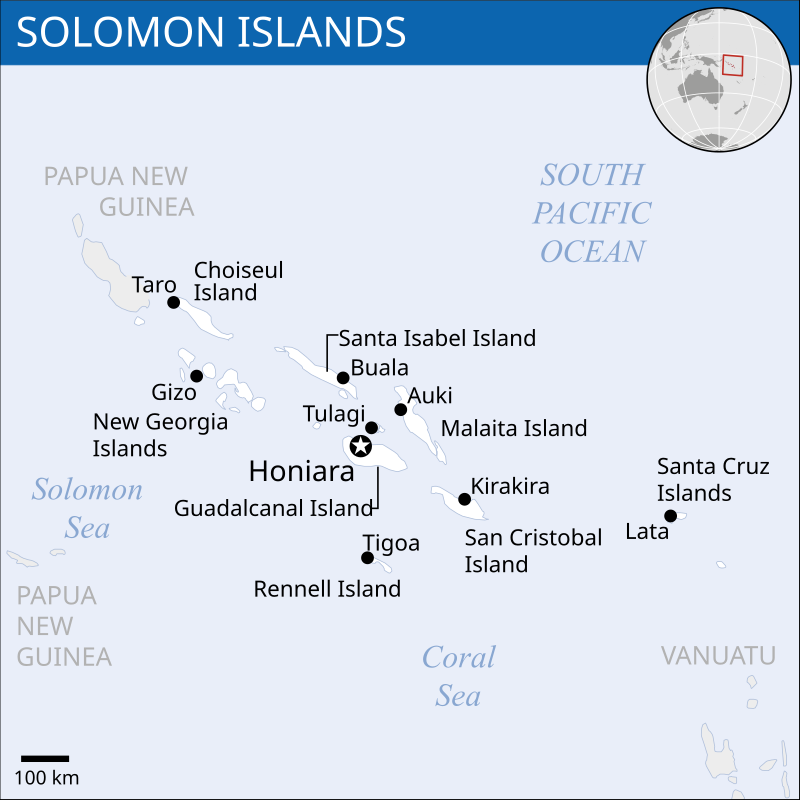
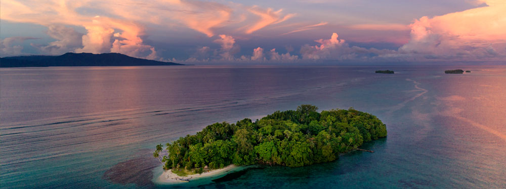
After a long time posting about the Summer Learning Journey, I am going to post about a country that you might not know, like always, I will give you some hints about this country. This country is an island country, located in Oceania. Last post, I had posted about a country located in Africa named Somalia, which is a territory located in the Horn of Africa. This country is located near Papua New Guinea and Vanuatu.
This countries name is Solomon Island. Now let's know some facts about Solomon Island.
The population of Solomon Islands is 629,166, which is more population than countries like Vanuatu, Iceland, Samoa, Guam, Kiribati, Tonga, Bermuda, Greenland, Palau, Cook Island. Tuvalu, and more.
The official language of Solomon Islands is English and Melanesian dialects.
The major religion of the Solomon Islands is Christianity.
The currency of Solomon Islands is Solomon Island dollar.
The calling code is +677.
The time zone of Solomon Islands is GMT +11.
Drivers in the Solomon Islands drive in the left side.
Honiara - which is Solomon Islands' capital city. Which has National Parliament frescoes and WWII relics at the National Museum.
Guadalcanal - which is one of the islands in the Solomon Islands, which has the capital, Honiara.
Rennell Island - which is one of the islands in the Solomon Islands, the island is known for the raised coral atoll with a massive lake.
Gizo - which is known for surfing, scuba diving and snorkelling.
Savo Island - which is a volcanic island and is known for the WWII battlefield.
Kolombangara - which is known for rainforests, volcanoes, forests and hiking.
Tetepare Island - which has protected areas, turtles and rainforests.
Russell Island - which is known for beaches and scuba diving.
Vanikoro - which is known for forests, museums, monuments and history.
New Georgia - which is known for history, coral reef and lagoons.
Map of Solomon Islands
What's the next country?
From now, I will ask questions about what do you think is the next questions, I will give you hints about that country, try to guess it.
This country is located in the Caribbeans in North America. This island country is around the bottom of the Caribbean islands. So now it is your time to comment down below what country is it?
I hope you like my post the out Solomon Islands. Comment down below if you've learnt something new about the Solomon Islands. Have a cool day!! Bye!!
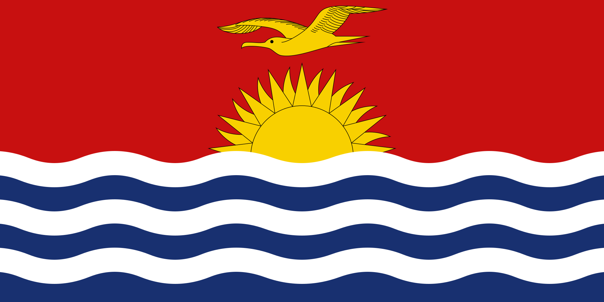
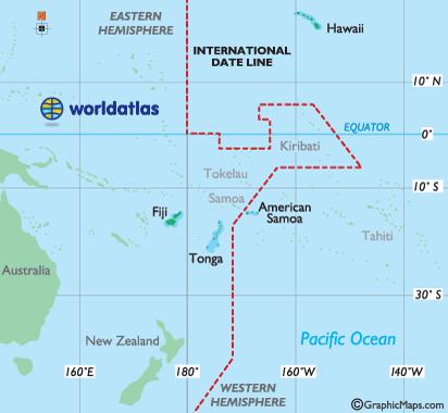
Welcome to the fourth episode of the 'Let's Know about Countries' series. Last post, I had posted about an island country named Palau. This post I will tell you about the first country to celebrate New Year's Day. This country is also an island country like my other posts in the series. This island country is located near the International Dateline and other parts of the Pacific Ocean.
This country is Kiribati. Kiribati has 32 atolls and one coral island. These islands are all around throughout the three island groups that form Kiribati. Kiribati is located in Oceania. It is near the International Dateline.
The population of Kiribati is 119,332, which is more than countries/islands like Tonga, Bermuda, Palau, Tuvalu and Nauru.
Let's know some facts about Kiribati:
The capital of Kiribati is South Tarawa.
There are two official languages English and Kiribati.
There are two currencies on Kiribati, Kiribati dollar and Australian Dollar.
Kiribati became independent from United Kingdom in 1979.
The average temperature on Kiribati is 31.4 degrees Celsius.
Kiribati is a member of the Commonwealth Games of Nations.
The IMF and the World Bank became a full member of the United Nations in 1999.
The ANZ bank (Australia and New Zealand Banking Group Ltd) is the only International banking company in Kiribati with branches on South Tarawa and Kiritimati Island.
People on Kiribati drive on their left side.
Map of Kiribati
Sport Kiribati has participated in the Commonwealth Games since 1998. Kiribati has also competed at the Summer Olympics since 2004. Kiribati won its first Commonwealth Games medal at the 2014 Commonwealth Games when David Kotoatau won Gold at the 105 kg group.
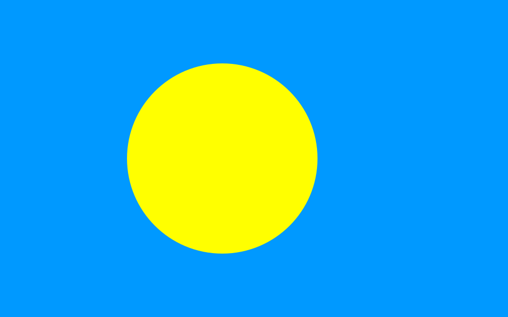
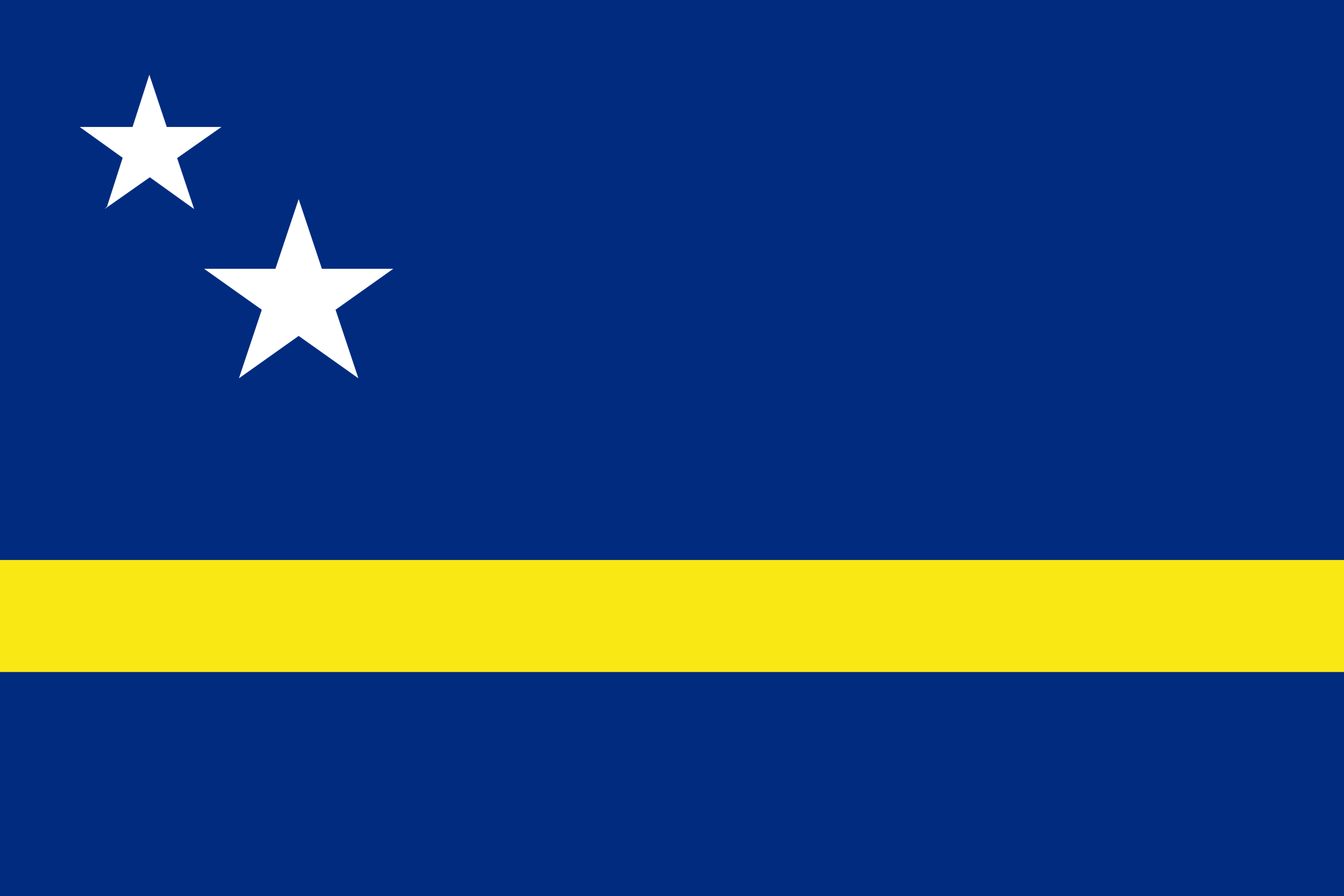
Welcome to the 'Let's Know about Countries' series. Last post, I had posted about an island country named Curaçao. Now this country is also an island country. If you don't know, an island country is a country that has one or more islands or parts of islands. This country is located in the western Pacific Ocean. The island country is near the Philippines, which is also an island country.
Flag of Palau
So I won't build the suspense that much. So this island country is Palau. As you know it is in Oceania and near the Philippines. Palau is an archipelago which has more than 500 islands!!
The main island of Palau is Koror Island. The area of Koror Island is around 7.8 km square. Koror Island is one of the Caroline Islands that is part of Palau. The largest city on Koror Island is Koror City. Koror City is half of the country's population. It was the capital until it was replaced by Ngerulmud in 2006. The average temperature on Koror City is 31° Celsius.
Let's go back to the topic and know some facts about Palau.
Palau is an archipelago which has more than 500 islands.
Palau's capital is Ngerulmud.
The largest city on Palau is Koror City.
The currency of Palau is the United States Dollar (USD).
Koror City covers half of the population of Palau.
There are five official languages on Palau: English, Japanese, Palauan, Tobian and Sonsorolese.
The country was settled 3,000 years ago from the Philippines.
Here are some places that you must go when you go to Palau:
Rock Islands - known for beaches and diving.
Jellyfish Lake - is a lake which is known for its ancient lagoon with two kinds of jellyfish.
Malakal Island - a tropical destination with a high-end beach resort, with restaurants and cocktail bars.
Ulong Island - is an island which is known for known for snorkelling.
Ngercheu - is an island which is known for scuba diving.
Koror-Babeldaob Bridge - is a bridge that connects Koror and Babeldaob Islands.
Nikko Bay - known for kayaking, beaches and snorkelling.
Palau has an international airport (named Palau International Airport or Roman Tmetuchl International Airport) which provides direct flights to Manila (capital of the Philippines), Guam (U.S. island territory), Seoul (capital of South Korea) and Taipei (capital of Taiwan). Since December 2010, Palau Pacific Airways also has charter flight (a flight by an aircraft chartered for a specific journey, not part of an airline's regular schedule, from Google dictionary) to Macau (a Chinese special administrative region) and Hong Kong (which is also a Chinese special administrative region). They have regular service to domestic destinations like Angaur (island) and Peleliu (island).
Sport
The most popular sport in Palau is Baseball. Palau international baseball team had won a gold medal at 1990, 1998 and 2010 Micronesian Games. Also at the 2007 Pacific Games.
Palau also has a national football team, organized by the Palau Soccer Association, but it is not a member of FIFA. Palau Soccer Association organizes the Palau Soccer League.
Travel Guide
This was episode 3 of the 'Let's Know about Countries' series. I hope you lime my post about Palau. Comment down below if you've learnt something new. Have a cool day!! Bye!!
Welcome to the 'Let's Know about Countries' series. In my last post, I had posted about the first country to see the sunrise. This country is in the Caribbean and it is an island country. An Island Country is a country that has one or more islands or parts of islands. In 2011, 46 (around 24%) of the 193 UN (United Nations) member states are island countries. New Zealand is an island country which has more than one island.
Flag of Curaçao
Let's go back to the topic. So this island country is Curaçao. It is a Dutch Caribbean island. Curaçao is known for its beaches. Let's know some facts about the country.
The capital of Curaçao is Willemstad.
The population of Curaçao is 161,014. Small right? Curaçao's population is higher than Aruba, which is an island country like Curaçao.
Curaçao has three official languages, English, Dutch and Papiamento.
The currency of Curaçao is Netherlands Antillean guilder.
The sovereign state is the Kingdom of the Netherlands.
There are a few destinations that you must go to:
Willemstad - Its old town & the floating Queen Emma Bridge.
ABC islands - Sailing, snorkelling and scuba diving.
Jan Thiel - Lagoons, beaches and snorkelling.
Westpunt - Cliffs, turtles, scuba diving and beaches.
Lagun - Scuba diving, snorkelling and beaches.
After the hyphen (-) it includes what the place is known for.
Map of Curaçao
Below is a video, which is a travel guide about Curaçao.
One of Curaçao's famous places is Klein Curaçao. Klein Curaçao is a 1.7km inhabited island south-east of Curaçao. Klein Curaçao is famous for diving-spot because of its coral and underwater caves.
So this was episode 2 of the 'Let's Know about Countries' series. I hope you like my post about Curaçao. Have a cool day!! Bye!!
Welcome to the first 'Let's Know about Countries' series. In the series, I will post, mostly every day about countries that you might not know about (some you may).
Have you ever wondered, which is the first country to see the sunrise? It's in North Gisborne, New Zealand. It is around the coast to Opotiki and inland to Te Urewera National Park. The East Cape has the honour of seeing the world's first sunrise each and every day.
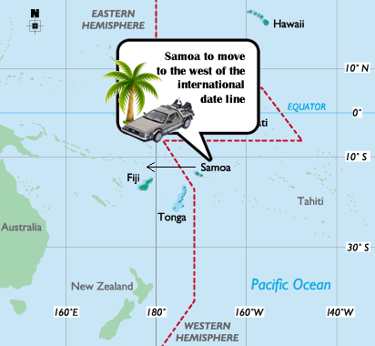
Back in 2011, Samoa decided to move position on the international dateline. Before, Samoa was the last place in the world to see the sunset. Many people on a trip to Samoa would visit Cape Mulinu’u where you could be the final people in the world to end the day. But, just because they are the first country to welcome the day, it still doesn't mean that they are the first ones to see the sunrise. The East Cape still holds the honour, thanks to the curvature of the earth. We may not be the first country to celebrate New Year's day anymore, but we are still the first country to see the sunrise.
When Samoa jumped 24 hours ahead, Samoa and American Samoa (in the US Territory) separated from each other.
So I hope you like my first post of the series. Have a cool holiday!! Bye!!